BLOG

Open Chalk Mine with AP-LiDAR-M Gen II
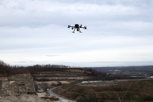
Extensive point cloud featuring an open chalk mine with a vertical wall of more than 40 m with millions of points captured in under 24 minutes and processed in just...
Open Chalk Mine with AP-LiDAR-M Gen II
Extensive point cloud featuring an open chalk mine with a vertical wall of more than 40 m with millions of points captured in under 24 minutes and processed in just...

Welcoming the new year with accuracy: How is Li...
The start of a new year often inspires fresh goals and ambitious projects. Whether you're in surveying, construction, forestry, or urban planning, LiDAR technology is your ally in achieving unparalleled...
Welcoming the new year with accuracy: How is Li...
The start of a new year often inspires fresh goals and ambitious projects. Whether you're in surveying, construction, forestry, or urban planning, LiDAR technology is your ally in achieving unparalleled...

Exploring the Applications of LiDAR: Who Uses It?
LiDAR is changing many industries by providing an unprecedented ability to create a 3D map in great detail. From mapping to town planning, users from different disciplines value adding LiDAR...
Exploring the Applications of LiDAR: Who Uses It?
LiDAR is changing many industries by providing an unprecedented ability to create a 3D map in great detail. From mapping to town planning, users from different disciplines value adding LiDAR...

How to Choose the Best LiDAR for Your Projects:...
Selecting the right LiDAR system for your project can make the difference between success and unnecessary setbacks. This post will explore the factors you should consider when choosing a LiDAR system...
How to Choose the Best LiDAR for Your Projects:...
Selecting the right LiDAR system for your project can make the difference between success and unnecessary setbacks. This post will explore the factors you should consider when choosing a LiDAR system...

How LiDAR is Revolutionizing Infrastructure Res...
The effects of climate change are putting our infrastructure to the ultimate test. From extreme weather events to rising sea levels, cities and industries must adapt to protect essential systems...
How LiDAR is Revolutionizing Infrastructure Res...
The effects of climate change are putting our infrastructure to the ultimate test. From extreme weather events to rising sea levels, cities and industries must adapt to protect essential systems...

How Cloud Solutions Are Killing Efficiency in t...
The surveying and mapping industry relies heavily on LiDAR technology, generating critical point clouds for accurate analysis and decision-making. However, cloud-based solutions, often considered a convenience, are proving to be...
How Cloud Solutions Are Killing Efficiency in t...
The surveying and mapping industry relies heavily on LiDAR technology, generating critical point clouds for accurate analysis and decision-making. However, cloud-based solutions, often considered a convenience, are proving to be...

