The biggest myths about LiDAR: debunked!
Ana Rouxinol
Though LiDAR technology revolutionizes industries like mapping, surveying, and automation, misconceptions persist. Some believe it is too expensive, too complex, or only suitable for large-scale projects. But is that true? Let's debunk some of the biggest myths about LiDAR scanners and separate fact from fiction.
1. LiDAR is only for large-scale projects
Many assume that LiDAR is only helpful for massive infrastructure projects like city planning or large-scale land surveying. The reality? Compact, high-performance LiDAR sensors are now widely used across diverse industries.
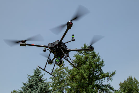
From construction and forestry to archaeology and precision agriculture, professionals use 3D scanning to streamline workflows, improve accuracy, and optimize decision-making. Even smaller-scale projects, such as monitoring erosion or mapping cultural heritage sites, benefit from the power of LiDAR on a drone.
2. LiDAR is too expensive
While it's true that LiDAR technology used to be cost-prohibitive for many businesses, that is no longer the case. The rise of compact, high-precision LiDAR sensors has made the technology more accessible.
Investing in a LiDAR scanner today means higher efficiency, better accuracy, and long-term savings. With on-site processing capabilities and automated workflows, professionals can reduce labor costs, eliminate unnecessary rework, and increase project efficiency, making LiDAR a wise investment for businesses of all sizes.
3. LiDAR data is too complicated to process
It's a common belief that LiDAR scanners generate massive amounts of data, requiring extensive computing power and advanced expertise. While this was true in the past, today's technology makes LiDAR processing faster and easier than ever.
With tools like the Aerial Precision app, you can use an iPad to process LiDAR data on-site in minutes. There is no need for high-end workstations or complex workflows. Just capture, process, and analyze your 3D scans in the field instantly.
4. LiDAR and photogrammetry are the same
Another common misconception is that LiDAR and photogrammetry are interchangeable. While both are used for mapping in 3D, they work in fundamentally different ways.
- • Photogrammetry relies on images to reconstruct a 3D environment, which can be affected by lighting conditions, shadows, and texture variations.
- • LiDAR scanners actively emit laser pulses to measure distances, making them highly precise and effective even in challenging environments like dense forests, low-light conditions, or featureless surfaces.
For professionals needing high-accuracy mapping in various conditions, LiDAR technology provides a more reliable and efficient solution.
LiDAR is the future! Are you ready?
The myths surrounding LiDAR scanners are fading as technology becomes more accessible, user-friendly, and cost-effective. Whether you're in surveying, construction, forestry, or archaeology, the benefits of precision mapping and 3D scanning are undeniable.
With advancements like on-site processing and compact, high-accuracy sensors, integrating LiDAR technology into your workflow is easier than ever. The question isn't whether LiDAR is worth it but how soon you will use it to stay ahead.