

LiDAR vs Photogrammetry in 2025: What's changed, and when should you use each?
Ana Rouxinol
In 2022, we broke down the fundamental differences between LiDAR and photogrammetry, two essential tools in the world of 3D mapping. But fast-forward to 2025, and the landscape has evolved. Hardware has become lighter, software smarter, and workflows faster.
Most notably, on-site LiDAR processing has shifted how surveyors and drone professionals operate in the field, enabling a full capture-to-output experience directly on mobile devices like the iPad. So, where do LiDAR and photogrammetry stand today? And when should you use one over the other?
Let's take a fresh look.
A quick recap: What are they?
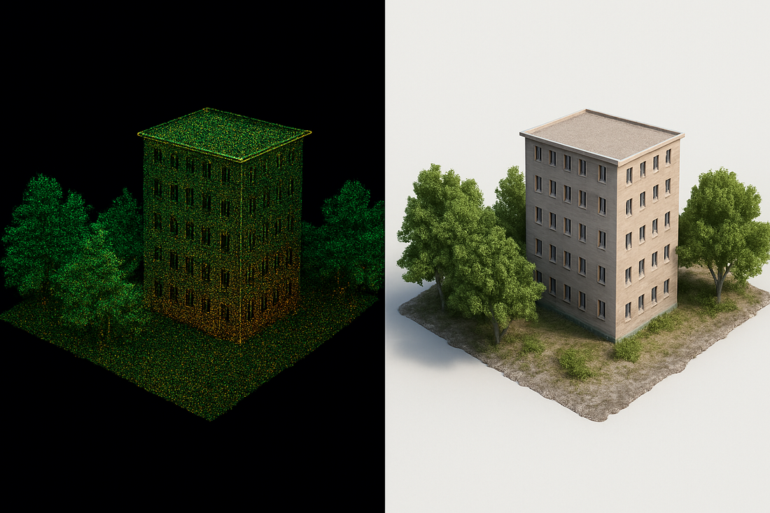
LiDAR uses laser pulses to measure distances with centimetre-level precision. It is highly effective in dense vegetation, dark conditions, and topographic mapping.
Photogrammetry uses overlapping images to reconstruct 3D models. It generates detailed, photorealistic visuals, especially in open, well-lit environments.
If you need a refresher, read our original comparison here.
What's new in 2025?
In 2025, the big story is speed and autonomy. Tools like the Aerial Precision app have redefined what’s possible in the field. Surveyors no longer need to wait days to process data. Now they can:
- Process LiDAR scans in minutes directly on an iPad
- Apply PPK corrections and align to GCPs offline
- Export to LAS/LAZ formats without leaving the job site
This level of control and immediacy is a game-changer, especially for those working in remote areas or under time constraints.
Side-by-side comparison: 2025 Edition
Feature |
LiDAR |
Photogrammetry |
|---|---|---|
|
Accuracy |
Up to ±3 cm (survey-grade) |
Variable; improves with GCPs |
|
Vegetation Penetration |
Excellent |
Limited |
|
Lighting Requirements |
Works in any light |
Needs daylight |
|
Processing Speed |
On-site in minutes (with app) |
Hours to days |
|
Output |
Dense 3D point clouds |
Textured 3D meshes |
|
Offline Capability |
Full (e.g. Aerial Precision App) |
Often requires cloud upload |
|
Hardware Cost |
Higher |
Lower (uses cameras) |
When to use what in 2025
Choose LiDAR if you're working in forested areas or low-light environments or need accurate elevation data quickly. It is ideal for civil engineering, environmental monitoring, and infrastructure inspection.
Choose Photogrammetry if you need detailed visuals or operate in open environments with good lighting. It is common in construction progress tracking, architecture, and cultural heritage documentation.
Use Both if you want the best of both worlds. LiDAR gives you accuracy, and photogrammetry gives you texture. Many projects benefit from a hybrid dataset.
The role of on-site processing
Apps like ours are pushing LiDAR to the front of the workflow. In the past, photogrammetry was often chosen for its ease of use and low entry cost. But today, on-site LiDAR mapping is not only possible, it's usually faster and more efficient than traditional photogrammetric workflows.
With tools like the Aerial Precision app, you can:
- View, process, and export data in minutes.
- Operate completely offline in remote regions.
- Avoid long turnaround times and cloud fees.
This transforms projects' execution and makes LiDAR accessible to more teams than ever.
In 2025, it's not about which technology is better. It's about choosing the right tool for the job. And increasingly, that decision comes down to speed, environment, and output requirements.
Whether flying a drone over dense forest or capturing a historic cityscape, knowing when to deploy LiDAR, photogrammetry, or both will keep your data sharp and your workflows future-proof.


