

Why a solid base station is essential for superior LiDAR data collection?
Ana Rouxinol
LiDAR technology has revolutionized industries like surveying, mapping, forestry, and autonomous vehicles by providing very precise 3D representations of the environment. The quality of LiDAR data, however, is heavily dependent on correct positioning, and that is where a solid base station comes into the equation.
This blog post will explore why a reliable base station is essential for LiDAR data collection and how it impacts accuracy, efficiency, and overall project success.
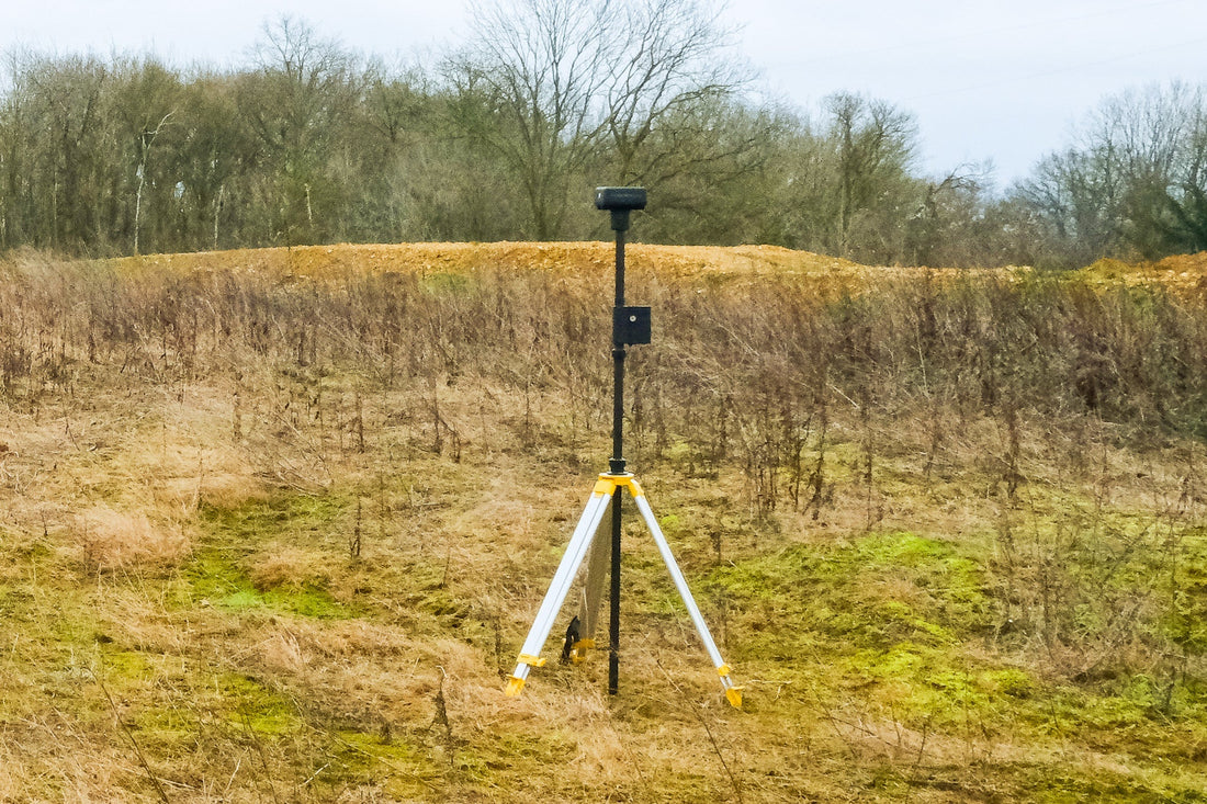
What is a base station in LiDAR data collection?
A base station is a fixed GNSS (Global Navigation Satellite System) receiver providing real-time corrections to a mobile LiDAR system (such, on a drone, vehicle, or handheld). These corrections help eliminate errors caused by atmospheric interference, satellite clock drift, and other GNSS inaccuracies, ensuring centimeter-level precision in positioning.
Without a base station (or with a poorly placed one), LiDAR data can suffer from drift, misalignment, and reduced accuracy, leading to costly rework and unreliable results.
Key reasons why a solid base station matters
1. Ensures high positioning accuracy
LiDAR systems incorporate GNSS information to georeference point clouds with maximum precision. A precise base station provides Real-Time Kinematic (RTK) or Post Processed Kinematic (PPK) corrections, significantly reducing position errors from several meters to a couple of centimeters. This is critical in the following applications:
- Surveying and engineering (road design, construction monitoring)
- Precision agriculture (elevation mapping, drainage planning)
- Urban planning (3D city modeling, infrastructure inspection)
2. Reduces data drift and misalignment
LiDAR data can exhibit drift without proper corrections, where the scanned points gradually shift from their true positions. A stable base station minimizes this issue, ensuring that long-duration scans remain consistent and aligned.
3. Improves data reliability for large-scale projects
For large-area surveys (e.g., forestry, mining, or corridor mapping), a well-placed base station ensures that data from multiple flights passes or drive runs seamlessly align. Poor base station setup can lead to gaps, overlaps, or misregistered point clouds, requiring additional processing time.
4. Supports efficient post-processing
Even if real-time corrections aren't used, having a base station with high-quality PPK capabilities allows for precise GNSS data post-processing. This is especially useful in areas with poor satellite visibility or intermittent RTK signals.
5. Saves time and money
Inaccurate LiDAR data can lead to expensive re-surveys, project delays, or flawed decision-making. Investing in a solid base station upfront ensures that data is correct the first time, reducing costly fixes later. ;
Best practices for base station setup
To maximize LiDAR data quality, follow these best practices when using a base station:
✅ Choose an optimal location – place the base station on a stable, open-sky area with minimal obstructions (e.g., tall buildings or trees).
✅ Use a known survey point – if possible, set up over a precisely surveyed control point for the highest accuracy.
✅ Ensure sufficient coverage – the base station should be within 10-20 km of the LiDAR system for best RTK/PPK performance.
✅ Monitor signal strength – check for multipath interference and ensure strong satellite reception.
✅ Record raw data – always log raw GNSS data at the base station for post-processing flexibility.
A high-quality base station is not just an accessory. It's a critical component of any LiDAR data collection workflow. Providing precise positioning corrections ensures that your point clouds are accurate, aligned, and reliable, saving time and resources in the long run.
Whether conducting aerial surveys, mobile mapping, or ground-based scans, investing in a solid base station setup will pay off in superior data quality and project success.
Need help optimizing your LiDAR workflow? Dive into our latest blog post for tips and tricks, or get in touch with us for personalized assistance! Let's elevate your projects together!


